Featured

Why I am keeping a Blog

A little housekeeping

Hello to all. I have been looking for a way to save pictures, thoughts, notes and general information about activities and adventures I have with my family and on my own. I have struggled with placing a lot of content on Facebook, because not all of my friends are interested in all the details of things I do and am interested in.

Trips I have taken, hikes I have been on, songs I have played, vacations and the like all have elements that I wish to journal post and keep notes for recall at a later time. I have found after some activities I don’t remember all the details of a trip and wish that I had kept some notes. The blog format seems for now the best way for me to do that. I hope friends and family will enjoy reading content and viewing pictures in my posts. Please know that I do not wish to brag, gloat, name drop or parade around anything I am doing.  This is mainly so I can keep notes about things that interest me. I am not a writer and have no formal education in writing. My grammar and use of punctuation may not be perfect, but that’s OK. I am also not versed in html editing or web page publishing. I am not very good with graphics and artsy type of stuff, so bear with me. I do hope to learn more about publishing as I make more blogs and pages. All content of my blogs and pages remain my property. Use or republication of all content, data and pictures is prohibited without express written permission of Joel T. Shannon, KC4WZB.

Enough of that! Thanks for taking time to read the why. Now onto the adventures of KC4WZB!


Wilson Mountain (W4G/HC-012) 12/16/2017

Well fresh off the Frozen Knob trail and having just finished off a Cliff Bar I was ready for the second Summit of the day. Wilson Mountain is very close to my Cabin. The trail head is on Doublehead Gap Road about a half mile from the turn off to Springer Mountain. There is parking for maybe two cars there. A fiberglass trail sign is in front of a large burm. Once over the burm you can get going on the trail. There was some really nice looking ground cover at the start of the trail. Several places along the trail are faint and some look like an ATV trail. You travel probably 1/2 to 3/4 mile in a bottom flat area full of white pines and some hemlock trees. It is thick in parts with small scrub. There is a section you have to bushwhack about 200′ to the ridgeline where you pick up a second trail. From there you are ascending the rest of the trail. It is fairly steep all the way. There are a few side trails. Without studying the area and keeping your whit as well as having a tool like All Trails or a GPS you could easily get disoriented. I managed to stay on track. This hike was about a mile and a half each way with around 750′ elevation gain. I heard what sounded like some pretty large game rustling around. As I was on the final push I saw four of the largest Turkeys I have ever seen way off in the distance.  I also saw a property corner marker just off the trail sticking out of the ground on a pipe about 18″ long. At the summit I changed into dry shirts/tops and got the antenna set up. I had no issues making contacts and was having fun. I only managed to operate on the 40 meter band and made 13 contacts. Those big turkeys made their way up pretty close to me while I was activating. They sounded like a bear in the woods they were so loud. They almost looked like ostriches they were so big. Daylight would fade and with the large ridge to the west and the thick woods it would be darker quicker on the trail. I set out at a quick but safe clip to get back before dark. I scratched a good marking on the ground where I needed to bushwhack back down to the lower trail. Once I was on the lower trail I knew I was good to go. I was tired from the long day, but excited to have a good wintertime activation with snow under my belt. My total Summits On The Air (SOTA) points are at 309. I am in third place after less than a year of activating. The two guys ahead of me have been at it for years. I will have been at it a year this coming January 29th. It has been a lot of fun. Can’t wait to get back on the trail!

Sorry, only a few pictures. Click here to check them out

Frozen Knob (W4G/NG-033) 12/16/2017

Well last weekend was a bust for hiking as we had a pretty heavy snowfall. I planned to make up for it this weekend with two summits. I laid out my tracks in All Trails and was packed and ready. I knew it was going to be cold, so I was layered accordingly and I also carried my new alcohol stove with some Starbucks instant coffee. I headed out and came to Woody Gap just above Suches to find a decent amount of snow. On the Suches side of the gap the snow was much heavier. I headed down Gaddistown road to FS 348. I went back in about 4 miles to the trail head. This trail is only about a half mile up to the summit, but there is about 700′ elevation gain heading up to this one. Snow was 6 to 8″ deep in spots making for slick and slow going. The snow was indeed pretty on the mountainside. The summit lived up to its name with temps in the 20’s it was definitely frozen! I eventually made it to the top. I quickly changed into dry top layers and hung up my sweaty clothes to dry. I got the antenna in place fairly quickly and set the radio up. Before getting a spot I decided to make a cup of hot coffee. I must say this is a luxury on the trail that I enjoyed very much. I had some new warm layers and hat that kept me toasty at the top. There was not as much snow on the top of the mountain as there had been coming up the side. I made 22 contacts and had a summit to summit contact with my pal Ryan WG4I. I even got up enough nerve to do a summit to summit contact on CW (Morse Code) with Mike Cartmill AC0PR. Mike was on 20 meters in Utah and I could barely hear him, but made the contact. That was quite a thrill. I packed up and headed back to the truck I didn’t know if I had it in me to do another summit, but decided to give it a go. The next summit was going to involve some bushwhacking late in the day, so I needed to get going.

Here are the really cool pictures of Frozen Knob

Coosa Bald (W4G/NG-006) 12/02/2017

I had a missed an activation earlier in the year of this summit and I was looking forward to bagging this peak. I set out fairly early armed with the tracks set out in my AllTrails App. I really like this app. You can load GPX track files from others hikes or from your GPS. You can also manually chart your course on top of topo maps. These can be downloaded for off line use and can be printed. You can time your trek and see if you are staying on track as well. I was ready to go. On the way up I stopped at Mountain Crossing at Neels Gap and picked up a Toaks titanium alcohol stove and a few other goodies. I parked at Wildcat Gap and headed up the mountain. I saw quite a few hikers coming down the mountain, but didn’t see anyone on the mountain. I have added a stadium seating pad to sit on instead of carrying a camp chair or hammock for super light weight set up. This has been a really good addition. It provides padding in the pack and is very comfortable to sit on. I took my time and knocked out 23 contacts. It was a super great day. I enjoy the solitude of solo hiking from time to time, but also miss my hiking partner and wife when she’s not there.  I found out the next day that Cris at my church had been on the same trail, the same day as me. Somehow we missed each other. We have been discussing for a few weeks now trying to plan a hike together.  Hopefully we will get in a hike soon.

Click here to view the pics from this trip.

Bell Knob (W4G/NG-035) 12/01/2017

Lynn and I took today off work. Tomorrow would be our 22nd anniversary! Lynn was going to be attending a ladies brunch at church tomorrow on our anniversary, so we took Friday off. We went to Blue Ridge and did some Christmas shopping. We had a nice lunch in town and headed to the cabin. After a little while there we headed out for Hiwassee to hit Bell Knob. This summit is now a drive up. There are still a ton of steps to get to the summit observation deck. Bell know may have the best 360º views of any summit yet. Unfortunately the whole place has been vandalized with lots of graffiti. I just do not understand this. I set up my Alpha Loop on the observation platform and worked 11 stations in short order. I packed things up and we headed into town and bought some things for the cabin. If you read last weeks activation at Ravencliff you know about the Crane Creek Vineyard and the Friday night Tapas. I had made us reservations. We went there after the activation at Bell Knob. When we arrived they let us try a few wines. We fell in love with a white they had called Catawba Christmas Wine. They only make a limited run every Christmas. We bought some bottles for gifts and learned we were going to have a musician there from Asheville. Our table was right next to the performer up front. The setting is very intimate with a roaring fire in the fireplace. While they were setting up Lynn and I stepped out on the porch and had a glass of wine sitting in the rockers. The Christmas lights in the mountains and the smell of the fire was very romantic. Lynn and I enjoy hanging out together as much if not more than we did when we first met. She has been such a blessing in my life, one that I am very thankful for.
Our table was ready and we went in and prepared to order. The menu was a great selection and Lynn and I loved every dish. The music was fantastic. The night was wonderful. Too bad we had to drive back to Suwanee tonight, but we enjoyed the night drive through the mountains.

Be sure to click here for pics.

Rocky Mountain (W4G/NG-050) 11/26/2017

After yesterday’s Ravencliff knob drive up and short hike I was ready for a good hike. It has finally gotten colder in North GA and I am ready to do some bushwhack hikes. After church at the Ridge, Lynn wanted to decorate the cabin for Christmas. This meant I was on my own. I had downloaded the tracks and printed some maps and trail guides for this one. This summit is accessed off of Cavender Gap Road in the Coopers Creek WMA area. The summit is also directly behind a church where my cousin is the preacher. I have been coming to Suches GA since I was a teenager. I used to Trout fish in the late 80’s and early 90’s every week at Cooper’s Creek. In fact, my second date with Lynn was trout fishing at Coopers Creek. She had said she really wanted to do that and wanted to go sometime. I told her to have her waders and fishing gear ready at a really early hour and I would take her . She showed up with all her gear. I took her, caught a mess of fish, went back to my grandmother’s house, cleaned and cooked the fish for her as well as some homemade hush puppies. I knew right then I had a keeper. It wasn’t much longer and we were engaged to be married. My Granny and Granddaddy Shannon’s ashes are scattered in Coopers creek. On the first anniversary of my dads death I camped out there by my self. Needless to say it is a special place to me. Oh yeah, back to the hike. It is hunting season and I am about to be walking through a WMA. Luckily I had Lynn’s Auburn University orange hoodie in the Jeep, so I figured that would be as good a hunter’s safety orange. I hit the trail. The guide I had said to take the left fork at .3 miles. At about this distance the road/trail forked. I followed it for a while and decided it was going all the way to the end of the ridge line. I decided to bushwhack straight up to gain the ridge line. This was quite a work out. I made the summit, set up, changed into dry top layers and started activating. The band was hot. I made 35 contacts! I decided since the time had changed and daylight was coming to an end soon I would pack it in. I went back down the ridge line and found a good path down. The GPS really came in handy. Turns out the fork to the left at .3 miles when I started was a really faint trail. This was probably a good half mile shorter on the return trip. Turns out I am not the only one to take this same rout. Pat KI4SVM had done the same. I changed tops again when I got to the Jeep and made it back to the cabin before dark. What a day!

Here’s the pics

Ravencliff Knob (W4G/NG-026) 11/25/2017

I have been wanting to hit this summit for some time. This is an FAA Vortac site. Wikipedia’s definition is: A VORTAC is a navigational aid for aircraft pilots consisting of a co-located VHF omnidirectional range (VOR) beacon and a tactical air navigation system (TACAN) beacon. … Most VOR installations in the United States are VORTACs
This site is very close to the town of Young Harris. You have to hit a few gravel roads to get there, but its not too bad. It is almost a drive up. Seeing how this site is not a tree top type of site I was looking forward to activating using my Alpha Loop magnetic loop antenna. I took my fiberglass mast and set up my dipole as well.  The Alpha loop is a really neat antenna. The matching network’s air capacitor mounts to a tri-pod. This is a fairly portable antenna. I had tested this one at home. It even works really well indoors. Alpha makes antennas for the military and is a great American company. These guys are all about customer service. I ordered this antenna in hopes of using it on my Hawaii trip. I ended up not using it on the summits, but did from my hotel. The owner of the company sent me a thank you email for ordering the antenna. The antenna came in, they followed up to tell me about their production and see how I liked the product. I had tested it out and was pleased. Upon packing it back up I didn’t break the thing completely back down thinking I could bend the coax into fitting the bag. When I did one of the pressed fittings broke at the Tee. I emailed them late at night. They immediately responded. The owner was about to be off for a few days and had his production manager contact me. They knew I had a trip planned, so the over-nighted a new Tee with a couple of spares for no charge. These guys are great. Anyway, I used the loop at Ravencliff on 20 meters. I had a contact to Quebec with 15 watts! Several other stations as well. My dipole did a great job as usual. Lynn, Sparkles and I headed down the mountain. We had seen a sign for Crane Creek Vineyard at one of our turns close to the summit road. Lynn and I had been there several years ago and we decided to drop in on our way back. We picked up a bottle of Hellbender wine, some sausage, cheese and crackers. We consumed it outside with an incredible view of the vineyards and the mountains. We had Sparkles in the Jeep, but we knew the place was dog friendly. We asked the owners if it was ok to get the dog out. They said absolutely, but to keep her on a leash so it didn’t run off on their 40 acres. We looked around and several dogs were off their leashes. It was cool outside, so we left Sparkles in the Jeep. Some patrons sitting near us explained all of this. We had these two dogs begging for food. We thought it belonged to them, but they explained all the dogs running around were rescue dogs the owners of the vineyard had rescued. The vineyard owner is also a veterinarian. They told us about a Friday evening Tapas menu. We made note of this and said we would need to try this out. We were full after the cheese, sausage crackers and wine, so that covered our supper. We stayed at the cabin that night. Another great weekend in the mountains.

See our pics by clicking here

Mauna Kea on Big Island (KH6/HW-001) 10/27/2017

On our last Hawaiian trip in 2014 we went to Oahu and did a circle island tour with a trip to Pearl Harbor. Lynn really wanted to go check out the big island and see if we could see some active lava flows at Volcanoes National Park. So I booked us a flight from Maui and a room and rental car for a couple of days. Our plans were to try and hike / c=activate Mauna Kea summit one day and hit Volcanoes NP the next day. We got an early start and headed straight for the summit. The drive to get there had some incredible landscapes and elevation gain. With great views of Mauna Loa and Mauna Kea and the ocean on the way. We passed by some lava fields that looked really cool. We had rented a Jeep Renegade, which is a piece of junk. We got a little over half way up the summit and the car cut off. It cut back on, but we didn’t want to take a chance and headed back to the rental car place and got a 4wd pickup. We had just enough time left to get to our hotel, then catch a dinner cruise we had booked. My business partner Kevin and his wife Karen met us for the cruise. The cruise was great. We had a nice Hawaiian lady give a historical tour the entire way. We got to see Captain Cook’s burial spot and take in a very good meal at sunset. A talented local musician sang and played guitar with original pieces, Hawaiian favorites and covered standard tunes as well. This was one my favorite things we did on the whole trip, other than summit activations of course. Speaking of which, equipped with our new 4wd pickup after a good nights sleep and a great breakfast we headed back to Mauna Kea summit. This summit is no joke. It is the tallest mountain on earth from base of the mountain to the summit, only most of it is submerged. It’s summit is a very high 13, 768 feet above sea level. The road to it past the visitors center (9,000′ asl)is not paved and it gets graded on a regular basis. This road gets closed when there are clouds, snow, ice or low visibility. Yes it snows there. We came home and a month later the summit was on the weather channel covered in ice! The pickup had no probelm. You really need 4wd low gear to get back down without burning up the brakes. I made sure to write down all of the local VHF & UHF repeaters so I could corral people to simplex in hopes of a quick activation. This was a smart move. I had hoped to also set up an HF antenna, but gave up on this quickly. First of all the summit is controlled by the University of Hawaii and has observatories, HUGE observatories funded and operated with the help of 27 countries around the world. At the summit there are signs that say not to even use your cell phones so as to not interfere with the radio telescopes. Second, the trail to the summit had a sign that said to stay off of it due to religious significance to Hawaiian locals. I checked in with the ranger. He said it was OK to hike to the summit, just to not touch anything especially the alter at the top. He watched us the whole time from the parking area, so I did not chance getting out my new Alpha Loop antenna or dipole. Having the repeater info handy paid off and I was able to get the needed contacts and wrap up the activation. This is the highest I have been. I had no issues at all with the elevation as I had been sure to adequately hydrate and slowly acclimate before climbing the hill. One side of the summit looked to have a huge wall of thick white clouds several thousand feet below the summit. It was like there was an invisible boundary keeping them from coming farther. I guess there is, as one side of the island gets a couple of inches of rain per year and the other gets a couple of hundred inches! Unfortunately that is where we were heading. We came down the mountain, made a left and went from clear skies to zero visibility in 1/4 of a mile. This is the craziest thing I have ever seen. We had about two hours to drive to the national park. On the way we were in constant rain, fog or drizzle. We saw some cool trees in the rain forest. The Koa trees are really cool. Unfortunately you can’t drive anywhere near the active lava and it takes several hours to hike to these area. We didn’t have that much time and it was raining to boot. We did catch a cool movie at the visitors center and went to the crater/cinder cone. At night you can see lava glowing in the cone. We had zero visibility, but you could smell the sulfur. We headed back to the airport,the way we had came and rode right back into clears skies. We made it to the airport only to find our flight delayed a couple of hours. It was a great trip all in all.

Lots of great pics by clicking here

Red Hill aka Haleakala (KH6/MA-001) 10/22/2017 and Maui Trip

Lynn and I have been blessed with the opportunity to go to Maui a second time. This time around I am getting to work in some portable ham radio work. Our company belongs to an association that was having their annual conference, so we got to go. The entire week was great. We had been in 2014 to Maui with the same group and had chocked every single minute with getting to see and do everything you can think of, so this trip was a lot more laid back to relax. We had been to Haleakala before, but had not gotten on the radio there. It is a drive up, but is above 10,000′. There are a ton of trails if you had time to make a longer hike. I had read from several hams that had activated this summit that they had no issues with the park service. I guess it depends on who’s on staff that day. In order to activate on HF and make long distance contact you really need to put up an antenna and it draws attention to you. I hiked up the hill and tried to get off the beaten path. I was able to tie off my fiberglass mast to a sign post and only partially extend it. I suspended my inverted V from the mast and was able to get on 40 meters. At the time of day I was activating, at best I could only reach folks on the surrounding islands. I only got three contacts and you need 4. I switched to 20 meters and was hearing foreign stations and west coast stations, but before I could get another contact in a ranger came by and ask me to wrap things up. I did then had to rely on getting my 4th contact on VHF/UHF with my small handheld radio. I had to call out on a local repeater and get a guy to meet me on a simplex frequency for the last contact. This took some time and perseverance, but it was worth it. My wife is very patient with me and is also really supportive. I now officially had a Hawaiian 10 point summit in the bag and the highest elevation for me so far. The views from Haleakala are sublime. You are above the clouds and it looks like you are on the surface of Mars, hence the name “Red Hill”
Our stay was at the Grand Wailea, a Waldorf Astoria hotel. Top notch and nicest on the island. Most expensive too I might add. We get travel credits through the association, otherwise this might be out of reach. There were many more receptions and dinners this time due to one of our chapter members being sworn in as the national president of the association. There were quite a few educational events to attend, so our free time was limited a bit. Still a great trip. I am posting several pics in the link. During this week we also went to the Big Island. I will post those details separate from this post.

Enjoy the pics by clicking here

Piney Mountain (W4G/HC-021) 10/18/2017

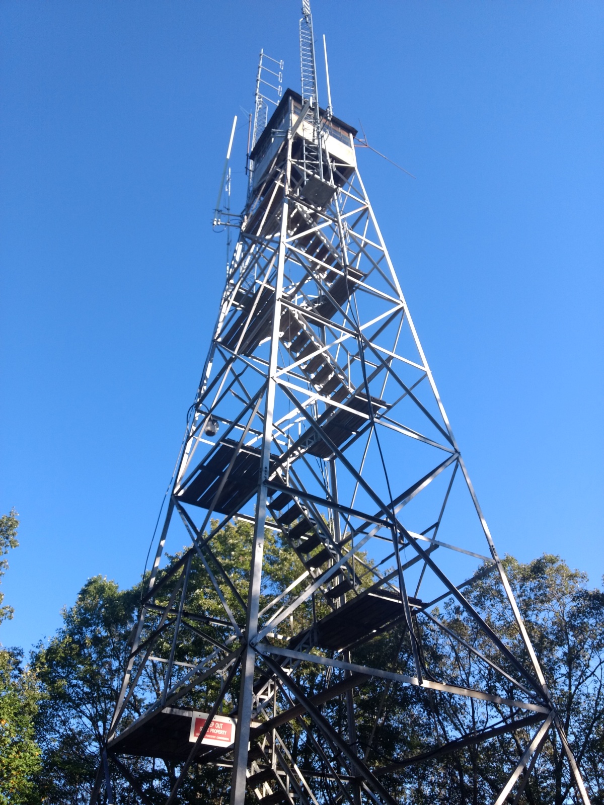
On a Wednesday Lynn and I decided to leave the office a couple of hours early and head to the mountains for a quick hike, radio activation and hit our favorite local restaurant in town.  We also would stop by the cabin and check on things before we head out in a few days for Hawaii. Piney Mountain is almost a drive up summit. You have to park at a gate and finish the hike to the summit, where there is a Forestry Service tower. There are some of the best home site mountain views I have seen going up this mountain. We got to go inside a house being built really close to the gated FS road. Really nice.
We headed up the hill and got set up pretty quickly. I had 11 contacts in the bag in no time. We headed back down and made it to the cabin before dark and got a nice sunset pic. Then on to Chester’s for a great meal and back to Suwanee in time for bed. I am going to miss these long days with daylight when the time changes. Fall has not quite got here, but that’s OK. Heading out later this week for a great time in Hawaii on the island of Maui and the big island. Hoping to get in at least two SOTA activations while I am there. 73 DE KC4WZB

Oh, don’t forget to check out the pictures by clicking here.

Rocky Top (W4G/NG-053) & Trip to Mercier’s Apple Orchard 10/14/2017

Today Lynn, Izzy and I were at the cabin and decided to hit Mecier’s for a tour. We got there, ate breakfast, then went out for the tour Not much of a tour. We heard a few interesting facts from a really nice man about the farm. He told us what apples were in season ready for picking, pointed out their locations in the orchard and dropped us off for picking. We picked several apples and had a great time. We got some fresh popped kettle corn and headed back to the cabin. I am pretty sure Izzy had homework and Lynn wanted to sew, so I headed out to a drive up summit. These are quicker and easier than ones you have to hike to. I don’t like them as much and refuse to do the ones that are in subdivisions. The one for today involved getting off-road in the Jeep and climbing Rocky Top, a nice summit with radio towers. I was able to set up my KX3 and make a bunch of contacts, 30 to be exact. I had several good conversations and really enjoyed the activation. I headed back to the cabin and we were able to have a fire in the fire pit and relax and hang out with John. I love weekends like this, where everyone gets to enjoy themselves and have fun.

Check out the pics from this weekend. click here